
Discover geographic information systems
If you’re a visual learner and a problem solver who is inspired to make sense of the world around you, UNE’s minor in Geographic Information Systems (GIS) may be the perfect addition to your college transcript. Using computer technology to map and analyze all types of data tied to geographic location, GIS is being used in the workforce in an ever increasing array of professional fields. From wildlife and climate studies to political science, economics, business, and public health, more and more jobs in a growing number of sectors are rapidly becoming reliant on employees with knowledge of GIS. This incredibly hands-on minor starts preparing you for real-life GIS applications on day one so that you graduate career ready.
Why UNE
UNE’s GIS minor is designed to give you the tools and experiences you need to incorporate GIS into your academic major and career. Benefitting from our small class sizes and exceptional hands-on experiences, you’ll be able to focus your fieldwork projects on your particular interests, enabling you to bring a whole new skill set to your major field of study and setting you up for greater success in your future career.
- Unique opportunities to create GIS-related projects in the UNE Makerspace
- Guaranteed internship experience
- Focus on hands-on learning
- Close working relationships with faculty members
I recommend UNE’s Geographic Information Systems minor to any individual looking to enter any environmental field with an upper hand, as the knowledge and ability to use GIS appears to be one of the most sought-after skills by employers today.” — Garett Bozek ’20, Environmental Studies major/GIS minor (GIS Analyst and Environmental Scientist, Tetra Tech)
Academics
Experiential Learning
With the goal of preparing you to step off of the graduation stage and into a successful career, we emphasizes hands-on learning at every step throughout the GIS minor, providing classroom activities and internship opportunities that give you real-world experience.
Classroom Activities
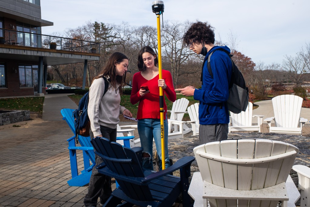
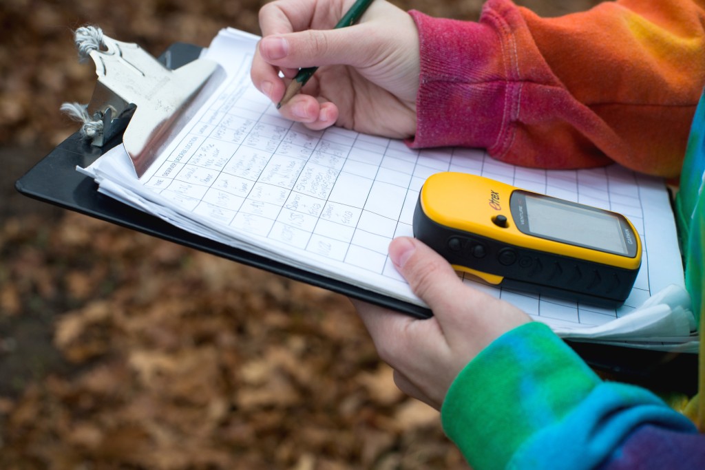
- Mapping erosion along salt marshes on campus using GPS and drones
- Mapping trails in nearby conservation land
- Using GPS units to map trees on campus
- Predicting the impact of sea level rise on Hills Beach and coastal New England using drones, GPS, and satellites
- Using satellite imagery to map the impacts of climate change and deforestation from the equator to the poles
- Using census data to see how demographics in Maine have changed over the last 50+ years
Internships
- Saco Watershed Collaborative
- City of Portland
- Center for Wildlife Studies
- UNE North: The Institute for North Atlantic Studies
- Town of Kennebunkport Public Health Department
- Massachusetts Environmental Police
- Old Orchard Beach Town Planning Office
- York County Soil and Water Conservation District
- Wells National Estuarine Reserve (U.S. Fish and Wildlife Service)
Experience GIS Drone Mapping Research
Examples of Available Courses
You’ll earn the GIS minor with the following required courses:
- Fundamentals of Geospatial Science and Technology
- Application of Geospatial Science and Technology
- Remote Sensing/Remote Sensing Lab
- Spatial Analysis/Spatial Analysis Lab
- GIS Internship
Curriculum
A student with a major in the School of Marine and Environmental Programs or another program may minor in Geographic Information Systems with the approval of the Academic Director. A minimum of eighteen (18) hours of approved course credit in the following courses is required:
| Program Required Courses | Credits |
|---|---|
| GIS 161 – GIS I: Fundamentals of Geospatial Science and Technology | 3 |
| GIS 162 – GIS II: Application of Geospatial Science and Technology | 3 |
| GIS 224/224L – Remote Sensing/Remote Sensing w/Lab | 4 |
| GIS 364/364L – Spatial Analysis/Spatial Analysis w/Lab | 4 |
| GIS 495 – GIS Internship or GIS 410 – GIS Research | Variable |
| Minimum Total Required Credits | 18 |
|---|
For more information see the Academic Catalog.
Find your career
In multiple career sectors within the fields of government, conservation, consulting, and more, employers require that applicants possess GIS skills in order to even apply for positions. For many other careers, a background in GIS provides a significant competitive edge for employment, promotions, and raises. With GIS applications now being used so broadly across professional fields, a minor in this discipline is the perfect complement to so many UNE majors.
Knowledge of GIS is helpful in a wide variety of industries, including:
- Environmental and Natural Resources
- Engineering
- Utilities
- Urban Planning
- Agriculture
- Transportation
- Construction
- Epidemiology
- Archaeology
- Gaming
| Pair a GIS Minor With a UNE Major in | For a Career in the Field of |
|---|---|
|
|
|
|
|
|
|
|
|
|
|
|
|
|
average annual salary of a GIS analyst in the U.S.
projected compound annual growth rate of the global GIS market during 2020-2030 period