UNE students celebrate GIS Day
Students and faculty from the University of New England’s School of Marine and Environmental Programs, in collaboration with the P.D. Merrill Makerspace, recently partook in a virtual GIS Day celebration on Nov. 18.
The day showcases of the real-world applications of geographical information systems (GIS).
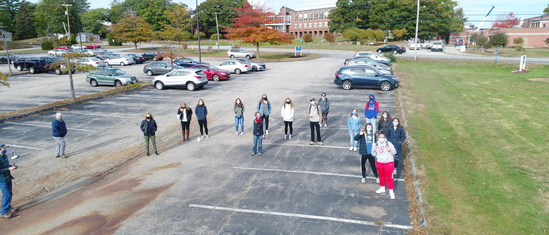
To celebrate the day, UNE entities organized an online event to discuss innovative applications of GIS technology in analysis, visualization, geospatial data insights, and thought leadership. The celebration included a drone-flying class, which taught students how to fly the aerial vehicles and exposed them to their conceptual applications.
“Like GIS systems, drones are flexible tools able to satisfy a wide range of professional needs,” said Marcia Moreno-Báez, Ph.D., visiting assistant teaching professor in the School of Marine and Environmental Programs. “Experience with drones exposes students to potential jobs in the fast-growing drone industry or broader careers in aviation. Students can use this knowledge to become pilots or explore jobs in programming, design, engineering, mechanics, and data analysis.”
The day also showcased students’ work throughout the semester, including web-based mapping and multimedia projects, and featured a virtual moderated panel of GIS technology experts as well as current GIS minor students Dean Hernandez (Marine Sciences and Environmental Science, ’22) and Garrett Hooper (Environmental Science, ’22).
The panel was moderated by Báez, Justine Bassett, director of the P.D. Merrill Makerspace, and Michael Esty, B.S., technical and project specialist in the Makerspace. The discussion featured special guests from the Environmental Systems Research Institute and the Strafford Regional Planning Commission.
Students responded positively to the virtual event.
"Technology will have a massive influence in my professional career, and the use of GIS will absolutely be a part of it,” said Elliot Boardman (Environmental Science and Environmental Studies, ’21), who said he would like to pursue a career in environmental consulting. “With this career path, I would use GIS to show particular areas and to visualize the data collected for both myself and the client.”
Haley Griffin (Marine Affairs and Marine Sciences, ’22) said use of GIS technology will help her in her pursuit of a career building sustainable communities.
“I want to work collaboratively with nonprofit organizations and government agencies to protect the environment and help marginalized populations develop sustainable practices that could help them improve their quality of life,” she said. “I believe that the advancement of technology is the most important aspect of being able to achieve this.”
Báez said the day was a great opportunity for students to network with professionals from around the world and share their work.
“UNE joined hundreds of organizations worldwide in hosting virtual gatherings that celebrated the impactful work of GIS professionals and to ignite the imagination of the future innovators who will further advance global progress using GIS,” she said. “Organizations across the globe are taking part in grassroots events that help celebrate geospatial science and how it impacts the real world for good.”