GIS students plot out research in Biddeford and beyond
Knowledge of geographic information systems (GIS) — a framework for gathering, managing, and analyzing data rooted in the geographical sciences — is vital to many industries, including environmental research and conservation, business management, and epidemiology.
At the University of New England, students minoring or taking courses in GIS ask questions about geography, locally and globally, to analyze the relationships between people, climate, and the environment across time and space. GIS helps students perform their investigations, make research or policy recommendations based on data, and improve the quality of people’s lives and that of the planet.
Among several research projects completed this past spring, three carried out by students taking Application of Geospatial Science and Technology with Marcia Moreno-Báez, Ph.D., visiting assistant teaching professor in the School of Marine and Environmental Programs, have showcased the importance of GIS mapping to both UNE, Maine, and the broader world.
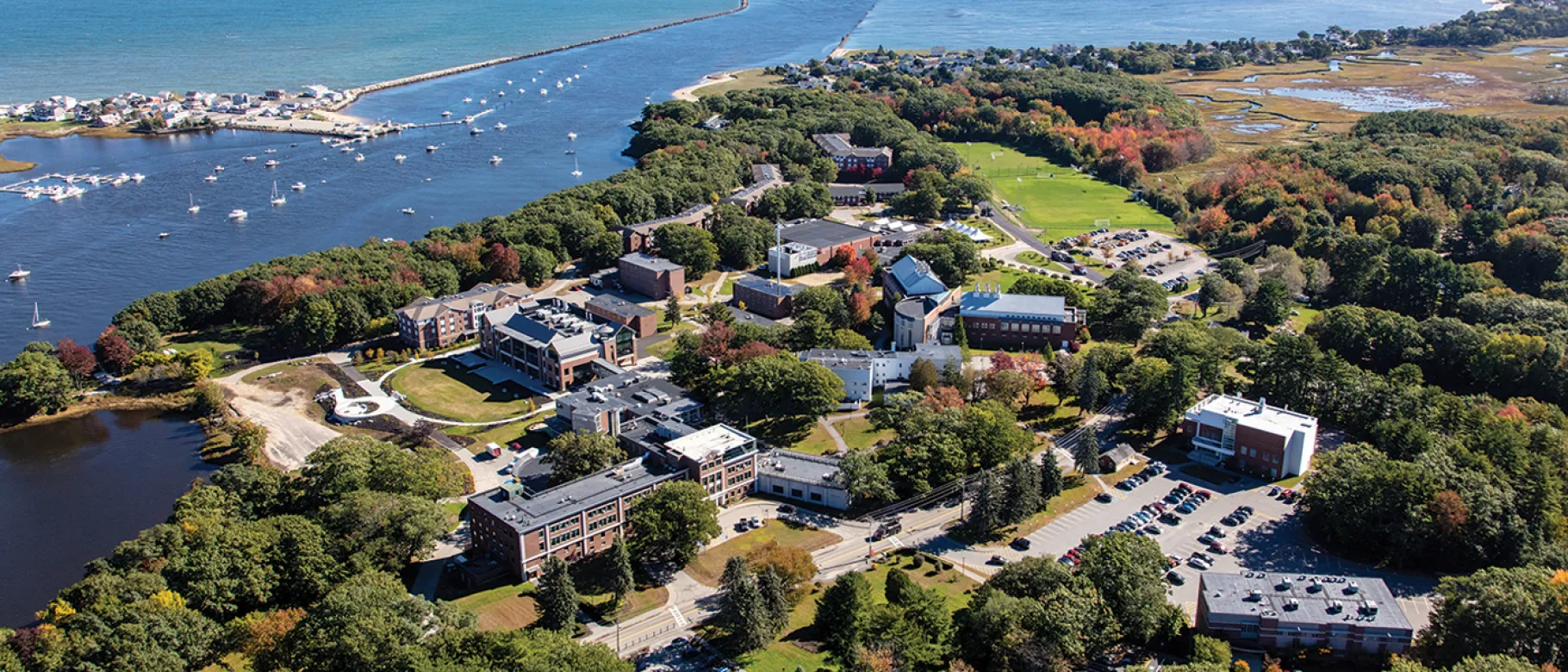
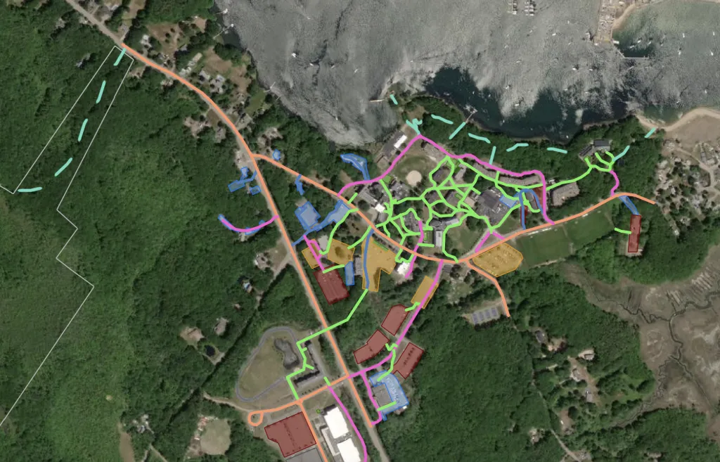
One such project, completed by Ryan Arbuckle, B.S. ’20 (Environmental Science), sought to map the trails of UNE’s Biddeford Campus, including its adjacent 363-acre forest, with the goal of inviting students to stay active during their time at the University.
“In my career, I see myself doing a lot of planning along larger plots of land,” Arbuckle said. “Environmental engineers need to be able to analyze the area they are working with, both on the ground and from a GIS perspective to complete jobs efficiently and to the upmost quality. Using GIS will allow me to better plan out my projects and properly assess the weight and scale of them.”
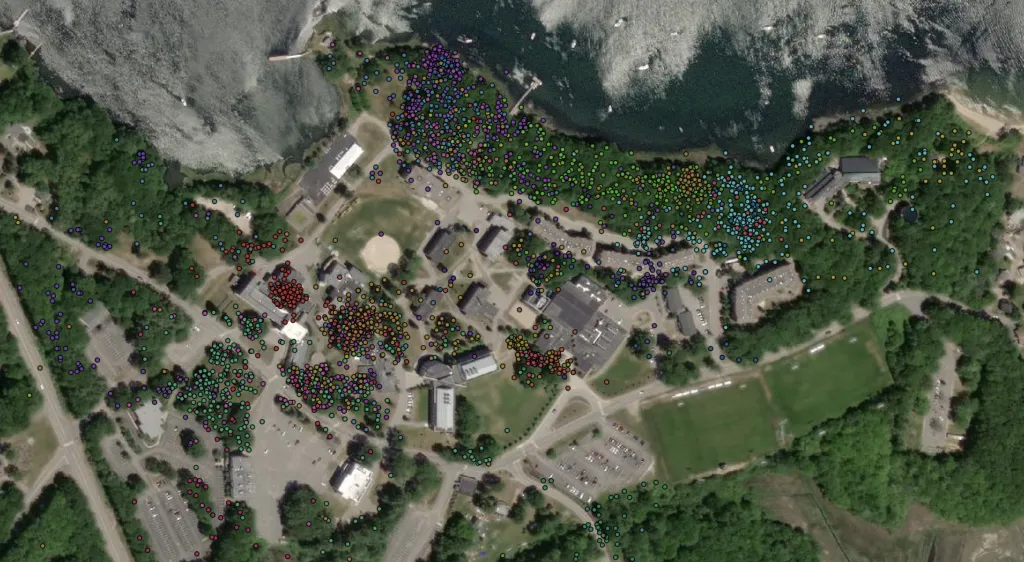
Working with Noah Perlut, professor in and assistant academic director of the school, Ethan Maskiell, B.S. ’20 (Environmental Science), used GIS to process datasets from Perlut’s Project Squirrel, a student-staffed research program that tracks squirrels on the Biddeford Campus.
Maskiell was able to successfully analyze and map out the information, which included a staggering 3,225 data points collected from 37 individual squirrels, and the project will help researchers understand the spatial distribution of squirrels, and their movements, on the oceanfront campus.
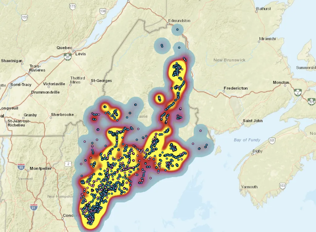
Beyond Biddeford, two students in the Class of 2022, Dean Hernandez (Marine Sciences and Environmental Science) and Garrett Hooper (Environmental Science), worked to map out “The Big Night,” a citizen science effort to monitor amphibian road crossings in Maine during the animals’ springtime breeding migrations to vernal pools.
Working with Jeffrey Parmelee, Ph.D., associate teaching professor at UNE, and graduate students from the University of Maine, Hernandez and Hooper developed tools to assist with data collection and visualization. They also performed spatial analysis of the amphibians’ movements and locations using data collected by all citizens collaborating on the project.
The experience, Hooper said, will give him a “leg up” against the competition when he enters the job market in two years.
“Not only will GIS help me get a job, but it will help me succeed in my career,” he said. “And even if the job I am applying for does not use GIS, I can use the skills taught to me to help me thrive in my career.”
Hernandez echoed that sentiment.
“GIS is applicable to almost any problem, and there is a way to incorporate it into any field of study,” he said. “The wide range of skillsets GIS provides has not only elevated me as a job applicant but will also aid me in my future research and graduate degree pursuits. It is a skill that will never cease to be useful throughout my career."